To give you the best possible experience, this site uses cookies. Using your site means your agree to our use of cookies. We have published a new cookies policy, which you should need to find out more about the cookies we use. View Cookies Policy.
Buy Marine Binoculars Levenhuk Nelson 7x50 - Stratosens.comMarine Binoculars Levenhuk Nelson 7x50
  • New
€189.95
Buy Monocular Levenhuk Wise Pro 10x50 - Stratosens.comMonocular Levenhuk Wise Pro 10x50
  • New
€129.95
Buy Spotting Scope Levenhuk Blaze Plus 90 - Stratosens.comSpotting Scope Levenhuk Blaze Plus 90
  • New
€319.95
Buy Digital Monocular Levenhuk Kelvin Snap ED 8x42 - Stratosens.comDigital monocular Levenhuk Kelvin Snap ED 8x42
  • New
Buy Digital Monocular Levenhuk Kelvin Snap 8x25 - Stratosens.comDigital monocular Levenhuk Kelvin Snap 8x25
  • New
€159.95
  • New
Marine Chart Navicarte R7 - Occidental Mediterranean

Marine Chart Navicarte R7 - Occidental Mediterranean

Review (0)
€24.95
Tax Included
Delivery in 5-7 labour days
Quantity :
  • Payments 100% SafePayments 100% Safe
  • Delivery in 5-7 labour daysDelivery in 5-7 labour days
  • Money back GuaranteeMoney back Guarantee

Marine Chart Navicarte R7 — Western Mediterranean

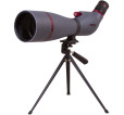
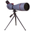
Plan your passages across the Western Mediterranean with confidence using the Navicarte R7 route-planning chart at 1:1 000 000. Designed for fast orientation and safe decision-making, it brings together clear symbology, prominent lights and marks, and concise port information on durable, water‑resistant paper. Built on trusted hydrographic data and compatible with modern GPS workflows, this chart is the dependable companion for skippers sailing the coasts of France, Spain and Italy across the Western basin.

Key Benefits and Applications

  • Panoramic Western Mediterranean overview — See the broader route at a glance, optimise tracks between major headlands and islands, and maintain situational awareness over long legs.
  • Fast, confident passage planning — The route scale makes it easy to sketch waypoints, bearings and contingency plans directly on the chart before transferring to your electronics.
  • Durable on deck — Water‑resistant, latex‑loaded paper resists spray and repeated folding, so the chart remains legible and reliable during active handling.
  • Port and navigation aids highlighted — Principal harbours, lights, beacons and buoyage are presented clearly to support safer approaches and checkpoints.
  • GPS‑friendly readability — Compatible geodetic and projection information keeps what you see on paper aligned with your onboard GPS and plotter readouts.
  • Bilingual legends for crew clarity — Explanations are provided in French and English to make symbols and notes quickly understandable by mixed crews.

Featured technical specifications

  • Chart classification and scale — Route‑planning chart R7 covering the Western Mediterranean at a scale of 1:1 000 000 for wide‑area navigation.
  • Geodetic reference — GPS‑compatible WGS 84 indicated on the chart, with information on Europe 50 corrections where applicable for positional consistency.
  • Hydrographic source — Bathymetric and coastal data produced under official agreement with the French Hydrographic Office, providing authoritative depth and coastline information.
  • Navigational content — Principal ports and approaches, lights and marks, colour‑coded hazards and depths, practical notes for navigation, plus black and white photo insets at key passages.
  • Paper and finish — Water‑resistant, latex‑loaded paper designed for write‑on use with pencil and for high resistance to folding even when wet.
  • Format and dimensions — Folded size approximately 165 × 315 mm for easy stowage. Unfolded size A0, about 118.9 × 84.1 cm for maximum readability at the chart table.
  • Language — Legends and essential notes in French and English for straightforward interpretation.
  • Maintenance — Periodically reissued to reflect navigational updates in the covered region.

Why this product is the perfect choice at Stratosens.com

At Stratosens.com you get the Navicarte R7 with expert guidance for selecting and caring for your charts, fast and careful shipping, and a commitment to supplying recent reissues whenever available. Pair it with our precision navigation tools and weather instruments to build a coherent, reliable planning setup that keeps your crew informed and your passages smooth from briefing to landfall.

105121405

No customer reviews for the moment.

Write your review
Marine Chart Navicarte R7 - Occidental Mediterranean
Buy Marine Chart Navicarte R7 - Occidental Mediterranean - Stratosens.com

Marine Chart Navicarte R7 - Occidental Mediterranean

€24.95
Tax Included
Delivery in 5-7 labour days