










To give you the best possible experience, this site uses cookies. Using your site means your agree to our use of cookies. We have published a new cookies policy, which you should need to find out more about the cookies we use. View Cookies Policy.
Buy Marine Binoculars Levenhuk Nelson 7x50 - Stratosens.comMarine Binoculars Levenhuk Nelson 7x50
  • New
€189.95
Buy Monocular Levenhuk Wise Pro 10x50 - Stratosens.comMonocular Levenhuk Wise Pro 10x50
  • New
€129.95
Buy Spotting Scope Levenhuk Blaze Plus 90 - Stratosens.comSpotting Scope Levenhuk Blaze Plus 90
  • New
€319.95
Buy Digital Monocular Levenhuk Kelvin Snap ED 8x42 - Stratosens.comDigital monocular Levenhuk Kelvin Snap ED 8x42
  • New
Buy Digital Monocular Levenhuk Kelvin Snap 8x25 - Stratosens.comDigital monocular Levenhuk Kelvin Snap 8x25
  • New
€159.95
  • New
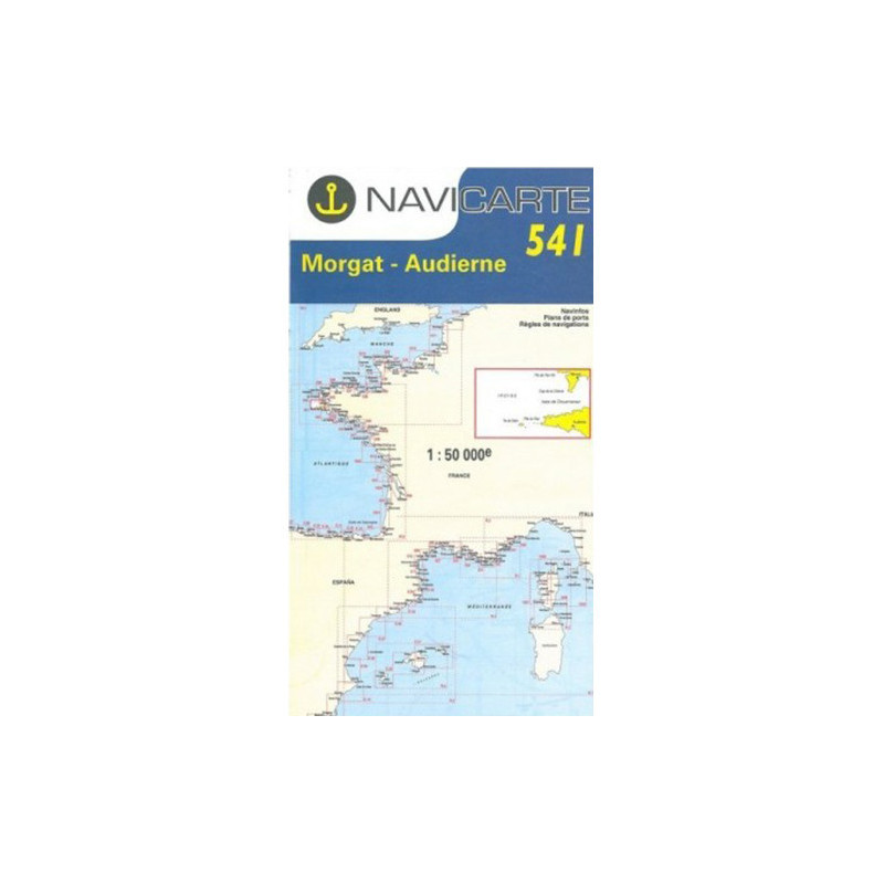
Marine Chart Navicarte 541 - Morgat, Audierne

Marine Chart Navicarte 541 - Morgat, Audierne

Review (0)
€24.95
Tax Included
Delivery in 5-7 labour days
Quantity :
  • Payments 100% SafePayments 100% Safe
  • Delivery in 5-7 labour daysDelivery in 5-7 labour days
  • Money back GuaranteeMoney back Guarantee

Marine Chart Navicarte 541 – Morgat, Audierne, Île de Sein

Navigate the dramatic coast of western Brittany with confidence using Navicarte 541, the trusted paper chart for the stretch between Morgat, Audierne and the renowned Raz de Sein. Designed for skippers who value clear, up-to-date cartography on durable, cockpit‑ready paper, this chart highlights coastal hazards, channels and approaches so you can plan safe routes, enjoy smoother passages and make the most of every tide. Depths are shown in metres and the intuitive colour scheme makes critical information instantly legible—exactly what you need when conditions change quickly.

Key Benefits and Applications

  • Sharp coastal awareness — Clear symbology and colour coding help you read the shoreline, seabed nature and hazards at a glance, enhancing safety during pilotage and close‑quarters manoeuvres.
  • Confident Raz de Sein transits — The chart emphasises headlands, channels and danger areas around the Raz de Sein, supporting smarter timing and safer course choices in this high‑energy zone.
  • Better approaches to ports and anchorages — Accurate depiction of beacons, lights and alignment marks streamlines entries to Audierne, Morgat and nearby harbours, reducing stress in low visibility.
  • Cockpit‑ready durability — Water‑resistant paper and a practical fold make it easy to handle on deck, take bearings, and stow quickly without sacrificing legibility.
  • Ideal for sail and power — Whether you are cruising, fishing or instructing, the chart’s clarity and scale support route planning, waypoint checks and on‑water decisions.
  • Perfect backup to electronics — Provides an independent, battery‑free reference for cross‑checking plotter data and maintaining situational awareness.

Featured technical specifications

  • Cruising area covered — Coastal waters from Morgat to Audierne including Île de Sein and the Raz de Sein sector, tailored for inshore navigation along Brittany’s Atlantic façade.
  • Working scale — 1:50 000 scale balances wide‑area route planning with the detail needed for coastal pilotage and approach work.
  • Soundings and heights — Depths and elevations expressed in metres for straightforward interpretation in European SI units.
  • Printing and symbology — High‑contrast colour palette with day and night buoyage shown in colour for faster recognition of marks, lights and sectors.
  • Paper and finish — Water‑resistant, robust paper engineered for repeated folding and use in humid marine environments.
  • Format and size — Supplied as a folded paper chart for easy handling; unfolded sheet size approximately A0 (about 1189 × 841 mm). Folded size approximately 165 × 315 mm for compact stowage.
  • Navigation utility — Clear latitude and longitude grid supports quick bearing plots, dead‑reckoning lines and transfer of waypoints from onboard instruments.
  • Data provenance — Produced under licence using official hydrographic sources, delivering reliable coastal detail for prudent navigation.

Why this marine chart is the perfect choice

Choose the Navicarte 541 from Stratosens.com to equip your cockpit with a precise, durable and easy‑to‑read paper reference for western Brittany. Our selection focuses on professional‑grade navigation tools that complement your electronics, so you can plan with confidence, verify positions instantly and enjoy safer passages through one of Europe’s most iconic—and demanding—coastal routes.

105120502

No customer reviews for the moment.

Write your review
Marine Chart Navicarte 541 - Morgat, Audierne
Buy Marine Chart Navicarte 541 Morgat Audierne - Stratosens.com

Marine Chart Navicarte 541 - Morgat, Audierne

€24.95
Tax Included
Delivery in 5-7 labour days