










To give you the best possible experience, this site uses cookies. Using your site means your agree to our use of cookies. We have published a new cookies policy, which you should need to find out more about the cookies we use. View Cookies Policy.
Buy Marine Binoculars Levenhuk Nelson 7x50 - Stratosens.comMarine Binoculars Levenhuk Nelson 7x50
  • New
€189.95
Buy Monocular Levenhuk Wise Pro 10x50 - Stratosens.comMonocular Levenhuk Wise Pro 10x50
  • New
€129.95
Buy Spotting Scope Levenhuk Blaze Plus 90 - Stratosens.comSpotting Scope Levenhuk Blaze Plus 90
  • New
€319.95
Buy Digital Monocular Levenhuk Kelvin Snap ED 8x42 - Stratosens.comDigital monocular Levenhuk Kelvin Snap ED 8x42
  • New
Buy Digital Monocular Levenhuk Kelvin Snap 8x25 - Stratosens.comDigital monocular Levenhuk Kelvin Snap 8x25
  • New
€159.95
  • New
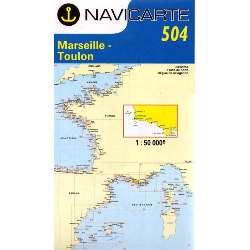
Marine Chart Navicarte 504 - Marseille, Toulon

Marine Chart Navicarte 504 - Marseille, Toulon

Review (0)
€24.95
Tax Included
Delivery in 5-7 labour days
Quantity :
  • Payments 100% SafePayments 100% Safe
  • Delivery in 5-7 labour daysDelivery in 5-7 labour days
  • Money back GuaranteeMoney back Guarantee

Marine Chart Navicarte 504 — Marseille, Toulon

Navigate the iconic coastline of southern France with confidence using the Navicarte 504 marine chart for Marseille and Toulon. Purpose‑built for skippers, racers and cruisers, it delivers clear coastal detail, precise depth soundings in metres and intuitive symbology that make planning and on‑water decisions faster and safer. From the approaches to Marseille and the Calanques to the busy roadsteads of Toulon, this chart provides the essential visual information you need for secure passages, efficient harbour entries and enjoyable day trips along the Côte d’Azur.

Key Benefits and Applications

  • Confident coastal navigation — Read shorelines, headlands and sea areas at a glance to choose safe tracks, identify hazards and maintain clear situational awareness in variable conditions.
  • Accurate harbour approaches — Approach Marseille and Toulon with clarity thanks to precisely plotted entrances, leading lines and navigational marks that support smooth arrivals and departures.
  • Efficient route planning — Use depth contours, seabed information and coastal features to design fuel‑efficient, comfortable routes for day sailing, cruising or regattas.
  • Enhanced safety margins — Identify restricted zones, anchorage areas and danger symbols early so you can adapt course and speed well before they become critical.
  • Reliable backup to electronics — Maintain navigation capability if power, sensors or displays fail, with a legible paper reference that complements your plotter and apps.
  • Training and certification use — Ideal for practising coastal piloting, bearings, dead reckoning and chartwork skills for practical courses and examinations.

Featured technical specifications

  • Geographical coverage — Focused on the Mediterranean coastline between Marseille and Toulon, including principal approaches, nearshore features and key coastal waypoints relevant to small‑craft navigation.
  • Depths and heights in SI units — Soundings expressed in metres with contouring that portrays gradients clearly for safe passage planning and anchoring decisions.
  • Projection and grid — Mercator projection with a readable latitude and longitude grid for accurate plotting, bearings and position fixing.
  • Geodetic reference — Compiled to modern charting practice with WGS 84 reference to align with contemporary GNSS receivers.
  • IALA Region A compliance — Buoys, beacons and lateral marks shown using Region A conventions to match the signalling system used along the French coast.
  • Navigational aids detail — Lighthouses with characteristics, sector limits where applicable, leading lines, recommended tracks and notable waypoints shown for practical pilotage.
  • Seabed and coastline information — Depth contours, banks, rocks, wreck symbols and shoreline features depicted for hazard awareness and anchoring assessments.
  • Legibility and symbology — High‑contrast cartography with internationally recognised symbols for quick interpretation under bright sun or low‑light conditions.
  • Durable chart stock — Printed on robust marine chart paper that folds cleanly for cockpit use and long‑term storage.
  • Small‑craft orientation — Scale and detail optimised for yachts, motorboats and RIBs operating in coastal waters rather than offshore ocean passages.

Why this chart is the perfect choice for your next Mediterranean passage

Choose the Navicarte 504 at Stratosens.com to equip your boat with a trusted, easy‑to‑read paper reference that complements your electronics and elevates safety on every mile. At Stratosens.com you benefit from carefully curated navigation tools, professional customer support and fast preparation for dispatch, so your chart arrives ready for immediate use on deck.

105120502

No customer reviews for the moment.

Write your review
Marine Chart Navicarte 504 - Marseille, Toulon
Buy Marine Chart Navicarte 504 Marseille Toulon - Stratosens.com

Marine Chart Navicarte 504 - Marseille, Toulon

€24.95
Tax Included
Delivery in 5-7 labour days