










To give you the best possible experience, this site uses cookies. Using your site means your agree to our use of cookies. We have published a new cookies policy, which you should need to find out more about the cookies we use. View Cookies Policy.
Buy Marine Binoculars Levenhuk Nelson 7x50 - Stratosens.comMarine Binoculars Levenhuk Nelson 7x50
  • New
€189.95
Buy Monocular Levenhuk Wise Pro 10x50 - Stratosens.comMonocular Levenhuk Wise Pro 10x50
  • New
€129.95
Buy Spotting Scope Levenhuk Blaze Plus 90 - Stratosens.comSpotting Scope Levenhuk Blaze Plus 90
  • New
€319.95
Buy Digital Monocular Levenhuk Kelvin Snap ED 8x42 - Stratosens.comDigital monocular Levenhuk Kelvin Snap ED 8x42
  • New
Buy Digital Monocular Levenhuk Kelvin Snap 8x25 - Stratosens.comDigital monocular Levenhuk Kelvin Snap 8x25
  • New
€159.95
  • New
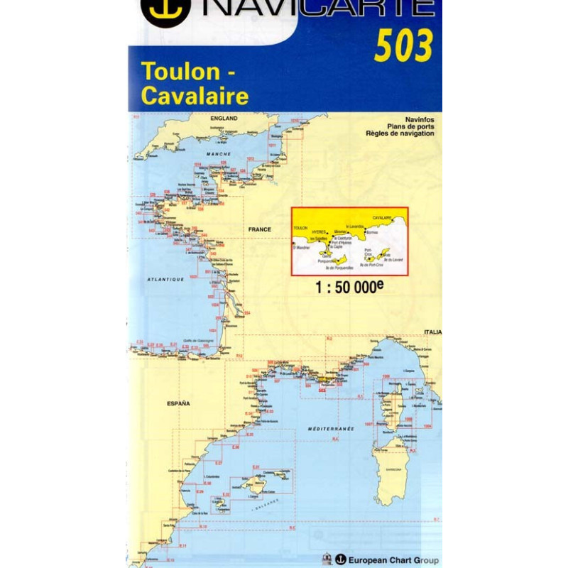
Marine Chart Navicarte 503 - Toulon, Cavalaire

Marine Chart Navicarte 503 - Toulon, Cavalaire

Review (0)
€24.95
Tax Included
Delivery in 5-7 labour days
Quantity :
  • Payments 100% SafePayments 100% Safe
  • Delivery in 5-7 labour daysDelivery in 5-7 labour days
  • Money back GuaranteeMoney back Guarantee

Marine Chart Navicarte 503 – Toulon, Cavalaire

Navigate the French Riviera with confidence using the Navicarte 503 – Toulon to Cavalaire, a coastal chart designed for skippers who demand clarity, reliability and effortless route planning. From the naval port of Toulon to the sandy bays of Cavalaire-sur-Mer, this chart highlights approaches, anchorages and marina entries with exceptional legibility, so you can focus on sailing. Ideal for cruising, charter and regatta support, it brings together clean cartography, intuitive symbols and metre-based soundings to make every decision safer and faster. Choose it on Stratosens.com to equip your boat with a precise, durable and cockpit‑ready navigation tool.

Key Benefits and Applications

  • Confident coastal navigation — Clear depiction of headlands, bays and channels between Toulon and Cavalaire helps you plot safe coastal routes and plan weather-conscious passages.
  • Fast, stress-free approaches — Distinct harbour outlines, entrance alignments and visible dangers simplify last‑mile manoeuvres when entering marinas or anchorages in changing conditions.
  • Superior readability under way — High-contrast colours, legible type and thoughtfully prioritised information make the chart easy to read at a glance on the cockpit table.
  • Optimised for modern instruments — Latitude/longitude grid, metre soundings and standard nautical symbology align seamlessly with GPS, plotters and onboard instruments for quick cross‑checks.
  • Built for real onboard use — Durable, water‑resistant print resists splashes and frequent folding, ideal for day sailing, cruising itineraries and charter operations.
  • Perfect for planning and training — Harbour insets and coastal detail support trip planning, skipper briefings and sailing‑school exercises along this Mediterranean stretch.

Featured technical specifications

  • Geographic coverage — French Mediterranean coast from Toulon to Cavalaire‑sur‑Mer, including key approaches such as Presqu’île de Giens and the Îles d’Hyères area, with principal harbours and anchorages clearly indicated.
  • Depths and heights in SI units — Soundings presented in metres (m) and land elevations in metres for precise, Europe‑standard interpretation.
  • Standard nautical symbology — Buoyage and marks follow IALA Region A conventions with intuitive iconography to support rapid recognition under way.
  • GPS compatibility — Geographic graticule and geodetic reference aligned for use with modern GNSS receivers, enabling accurate plotting and verification of positions.
  • Projection for marine use — Mercator projection facilitates course lines and bearings with consistent angular relationships across the chart.
  • Coastal-scale detail — Designed for coastal cruising and harbour entry, offering fine shoreline definition, seabed features and nearshore hazards relevant to day and night approaches.
  • Harbour and approach insets — Selected detailed plans for key marinas and anchorages in the area improve situational awareness during pilotage.
  • Durable, water-resistant paper — Tough, splashproof surface with crease‑resistant folds enhances longevity during cockpit handling and repeated use.
  • Clear contouring and shading — Depth contours and colour‑shaded shallows help visualise gradients and identify safe water at a glance.
  • Navigational notes — Helpful annotations on restricted areas, recommended tracks and caution zones support informed decision‑making.

Why this chart is the perfect choice for your navigation

Marine Chart Navicarte 503 brings together practical coastal coverage, metre‑based clarity and cockpit‑ready durability—exactly what skippers need between Toulon and Cavalaire. Ordering from Stratosens.com ensures expert selection, careful packaging for chart protection and prompt delivery, so you can set sail with a dependable navigation companion on board.

105120502

No customer reviews for the moment.

Write your review
Marine Chart Navicarte 503 - Toulon, Cavalaire
Buy Marine Chart Navicarte 503 Toulon Cavalaire - Stratosens.com

Marine Chart Navicarte 503 - Toulon, Cavalaire

€24.95
Tax Included
Delivery in 5-7 labour days